


- Understanding Geospatial AI: More Than Just Maps
- The Data Challenge Nobody Talks About
- What Makes a Geospatial AI Solution "User-Friendly"?
- Top User-Friendly Geospatial AI Solutions in 2025
- How Quality Data Annotation Powers User-Friendly Solutions
- The Role of Synthetic Data in Geospatial AI
- Building Your Geospatial AI Strategy: Practical Steps
- Why Macgence AI for Geospatial AI Projects
- The Competitive Advantage of Accessible Geospatial AI
What Are the Most User-Friendly Geospatial AI Solutions?
Finding the correct geospatial AI platform should not feel like navigating a maze. Yet, for product managers and CTOs, choosing solutions that strike a balance between power and usability often becomes the biggest challenge in deploying location-based intelligence.
The geospatial AI market is estimated to reach $2.3 billion by 2027, but here’s the one thing: not all solutions are created equal. While some platforms require extensive technical expertise and take weeks of training, truly user-friendly options are transforming how businesses extract insights from satellite imagery, drone footage, and location data.
The gap between what geospatial AI promises and what it delivers often comes down to one critical factor: the quality and accessibility of training data are important. Without properly annotated, diverse datasets, even the most sophisticated AI models struggle to deliver accurate results. This is where companies like us, Macgence AI, are changing the game, providing the foundation that makes your geospatial AI both powerful and accessible.
Understanding Geospatial AI: More Than Just Maps
Geospatial AI combines artificial intelligence with geographic data to analyze, interpret, and predict patterns across physical spaces. Think of it as giving machines the ability to understand our world the way humans do—recognizing buildings, tracking environmental changes, optimizing routes, and identifying patterns that would take analysts months to spot manually.
But here’s what most people do not realize: the “AI” part is only good as the data you feed it. A geospatial AI system needs thousands—sometimes millions—of accurately labeled images to learn the difference between a residential building and a commercial complex, or to track deforestation patterns across vast forest areas.
The Data Challenge Nobody Talks About
Traditional geospatial projects hit a wall when we need annotated data at scale. Manual annotation of satellite imagery is tedious and is also expensive, and prone to inconsistencies. A single high-resolution satellite image might contain thousands of objects that need labeling—roads, buildings, vehicles, vegetation zones, water bodies—and doing this accurately requires both technical expertise and geographic knowledge.
This bottleneck has historically made geospatial AI solutions complex and inaccessible for many organizations. The most user-friendly platforms today solve this by either providing pre-annotated datasets or annotation services that handle the heavy lifting for you.
What Makes a Geospatial AI Solution “User-Friendly”?
Before we dive into specific solutions, let’s establish what user-friendly actually means in this context. A truly accessible geospatial AI platform should offer these things:
- Intuitive interfaces that don’t require extensive GIS training. Your team should be able to start extracting insights within days, not months.
- Pre-trained models for common use cases like urban planning, agriculture monitoring, or infrastructure assessment. You shouldn’t need to build everything from scratch.
- Quality training data that’s already annotated and ready to use, or annotation services that handle the heavy lifting for your team.
- Flexible integration with your existing workflows and tech stack. The solution should fit your processes, not force you to rebuild everything.
- Scalability that grows with your needs without exponential cost or complexity increase.
- Clear documentation and support because even the best platform needs good guides and responsive help when you’re stuck.
Top User-Friendly Geospatial AI Solutions in 2025
Cloud-Based Platforms for Quick Deployment
Modern geospatial AI platforms have moved to the cloud, eliminating the need for expensive hardware and complex installations. These solutions offer pay-as-you-go models that make them accessible even for smaller teams testing the waters.
Platforms focusing on specific verticals—like agriculture, urban development, or disaster response—tend to be more user-friendly than general-purpose tools. We come with pre-configured models and also workflows tailored to common tasks in those industries, which significantly reduces the learning curve is what you want.
AI-Powered Annotation Tools
One of the biggest advances in user-friendly geospatial AI is that semi-automated annotation is important. Instead of manually labeling every object in every image, modern tools use AI to suggest annotations that human experts can quickly verify and refine. This hybrid approach, combining machine efficiency with human accuracy, works well.
We, Macgence AI, specialize in this exact workflow, providing geospatial annotation services that transform raw satellite and drone imagery into AI-ready datasets. our platform handles everything from simple object detection to complex semantic segmentation, making it possible to prepare training data in days rather than months.
What sets quality annotation services apart is our understanding of geospatial nuances, which is often missed. Annotating a satellite image isn’t like labeling photos of cats or dogs—it requires knowledge of geographic features, understanding of different terrains, and consistency across massive datasets.
Solutions with Pre-Built Industry Models
For teams that want to hit the ground running, solutions offering pre-trained models for specific industries are an invaluable asset. These platforms come loaded with models already trained on thousands of annotated images, so you can start analyzing your own geospatial data immediately.
Agriculture-focused platforms, for instance, might include pre-trained models for crop health monitoring, pest detection, and yield prediction. Urban planning solutions come with models for building classification, infrastructure mapping, and traffic pattern analysis.
The key advantage? You are not starting from zero, which is good. However, the limitation is that these models still need fine-tuning with your specific data to achieve optimal accuracy. That’s where accessing quality annotation services becomes crucial.
How Quality Data Annotation Powers User-Friendly Solutions
Here’s something that often gets overlooked in discussions about geospatial AI: the user experience of your AI solution is directly proportional to the quality of your training data are important things.
Think about it this way—if your model were trained on poorly annotated satellite imagery, it’ll make mistakes. Those mistakes mean your users spend more time correcting errors instead of gaining insights. That’s not user-friendly, regardless of how sleek your interface looks.
We, Macgence AI, address this challenge head-on by offering comprehensive geospatial data annotation services that ensure your AI models start with a solid foundation. Our services include:
- Satellite imagery annotation with pixel-level accuracy for land use classification, infrastructure mapping, and environmental monitoring.
- Aerial video labeling for tracking objects over time, essential for applications like traffic management and surveillance systems.
- LiDAR and 3D point cloud annotation that enables accurate spatial understanding for autonomous vehicles and urban planning.
- Geographic feature recognition that identifies and classifies natural and artificial features across diverse terrains.
What makes our approach particularly valuable for building user-friendly solutions is that the combination of AI-assisted annotation and human expertise is necessary. Automated systems handle the initial heavy lifting, while domain experts review and refine the annotations to ensure accuracy. This workflow produces high-quality labeled data at a scale and speed that would be impossible with purely manual methods.
The Role of Synthetic Data in Geospatial AI
As geospatial AI solutions mature, synthetic data is emerging as a powerful complement to real-world imagery. Synthetic data—artificially generated images that mimic real satellite or drone footage—can help fill gaps in training datasets, especially for rare scenarios or conditions that are difficult to capture.
For instance, training an AI model to detect flood damage across different terrains and building types would ideally require thousands of labeled images of actual flood events are helpful. However, catastrophic floods don’t happen frequently enough in any single location to provide that volume of training data. Synthetic data can help bridge this gap.
However, synthetic data is not a complete replacement for real-world annotation. The most effective approaches combine both: using synthetic data to augment training sets while relying on accurately annotated real-world imagery as the foundation, and are best practices.
We, Macgence AI’s data collection and annotation services, provide the real-world foundation that makes synthetic data augmentation effective, upon which you can rely. Our global network collects diverse geospatial imagery from different regions, terrains, and conditions, ensuring models trained on this data can generalize well to new scenarios.
Building Your Geospatial AI Strategy: Practical Steps
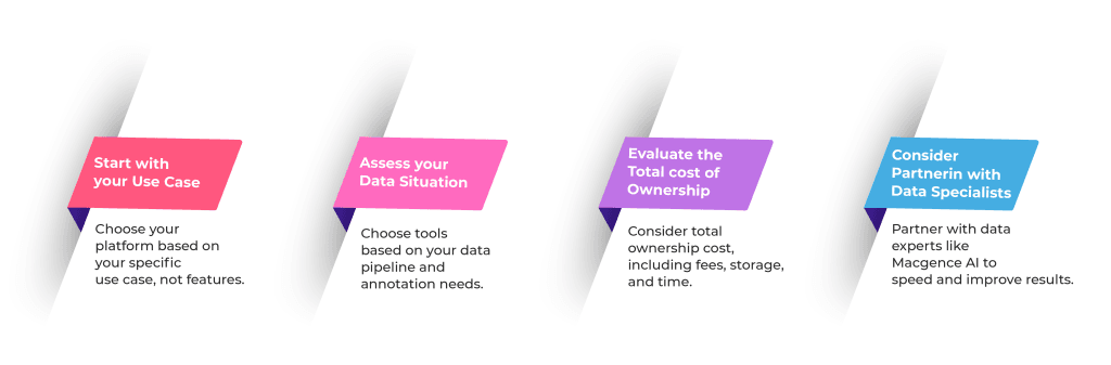
If you’re evaluating geospatial AI solutions for your organization, here’s a framework that can help you:
- Start with your use case. Don’t get distracted by features you don’t need. Are you monitoring crop health, planning urban development, optimizing logistics routes, or tracking environmental changes? Your specific application should guide your platform choice.
- Assess your data situation. Do you have existing geospatial data that needs annotation? Will you be collecting new imagery? Understanding your data pipeline helps you determine whether you need a full-service solution or just specific components.
- Evaluate the total cost of ownership. User-friendly doesn’t only mean easy to use—it also means predictable costs. Factor in licensing fees, data storage, annotation services, and the time your team will spend on setup and maintenance are crucial.
- Consider partnering with data specialists. Like us, Macgence AI, unless geospatial AI is your core competency, partnering with companies that specialize in data annotation and model training can significantly accelerate your deployment and improve your results.
Why Macgence AI for Geospatial AI Projects
When you’re building or deploying geospatial AI solutions, having a reliable data partner can make or break your project. Macgence AI offers several advantages that are particularly valuable for teams prioritizing user-friendliness are good things:
- Industry expertise across verticals. Whether you’re working in agriculture, urban planning, defense, or environmental monitoring, our annotators understand the domain-specific requirements that make your models accurate.
- Scalability without quality compromise. As your project grows from pilot to production, we can scale our annotation services to match your needs while maintaining the accuracy standards that your models depend on are important.
- Compliance and security. With GDPR, HIPAA, and ISO certifications, we handle sensitive geospatial data with the security protocols that enterprise clients require.
- Fast turnaround times. In the fast-moving world of AI development, waiting months for annotated data is not a valid option for many. Our workflows are optimized to deliver quality results fast.
- Flexible engagement models. Whether you need ongoing annotation services, one-time dataset preparation, or consultation on data strategy, we adapt to your project’s specific requirements.
The Competitive Advantage of Accessible Geospatial AI
The organizations that will gain the most from geospatial AI aren’t necessarily those with the biggest budgets or largest technical teams. We’re the ones who recognize the importance of user-friendly solutions backed by quality data.
By focusing on platforms that prioritize usability, partnering with data specialists like Macgence AI for annotation services, and building a solid data foundation, you can deploy geospatial AI solutions that deliver real business value without requiring a team of specialists to operate.
The question isn’t whether geospatial AI will transform your industry—it already has transformed it. The question is whether you’ll adopt solutions that make this transformation accessible to your team, or get bogged down in complexity that delays your progress is what you want to avoid.
Ready to explore how quality geospatial data annotation can power your AI initiatives? Connect with Macgence AI to discuss your specific needs and discover how our expertise can accelerate your geospatial AI deployment.
The future of location intelligence is here, and it is more accessible than ever before. The key is knowing where to start and who to partner with on the journey.

You Might Like

February 18, 2026
Prebuilt vs Custom AI Training Datasets: Which One Should You Choose?
Data is the fuel that powers artificial intelligence. But just like premium fuel vs. regular unleaded makes a difference in a high-performance engine, the type of data you feed your AI model dictates how well it runs. The global market for AI training datasets is booming, with companies offering everything from generic image libraries to […]

February 17, 2026
Building an AI Dataset? Here’s the Real Timeline Breakdown
We often hear that data is the new oil, but raw data is actually more like crude oil. It’s valuable, but you can’t put it directly into the engine. It needs to be refined. In the world of artificial intelligence, that refinement process is the creation of high-quality datasets. AI models are only as good […]

February 16, 2026
The Hidden Cost of Poorly Labeled Data in Production AI Systems
When an AI system fails in production, the immediate instinct is to blame the model architecture. Teams scramble to tweak hyperparameters, add layers, or switch algorithms entirely. But more often than not, the culprit isn’t the code—it’s the data used to teach it. While companies pour resources into hiring top-tier data scientists and acquiring expensive […]