


The Ultimate Guide to Geospatial Data Collection Providers
Geospatial data collection has become an essential part of modern industries, playing a vital role in urban planning, environmental monitoring, transportation, agriculture, and defense. With the advent of advanced technologies such as artificial intelligence (AI), satellite imaging, drones, and LiDAR, the geospatial industry is witnessing a rapid transformation. In this blog, we will explore some of the leading geospatial data collection providers, including Macgence, and how they contribute to this evolving sector.
Understanding Geospatial Data Collection
Geospatial data refers to information that is associated with a specific location on Earth. This data is collected using various techniques, including GPS, satellite imagery, aerial photography, and remote sensing. Geospatial data collection providers use these methods to generate insights that help businesses, governments, and research institutions make informed decisions.
Top Geospatial Data Collection Providers
1. Macgence
Macgence is a leading provider of human-generated and AI-powered geospatial data solutions. The company specializes in high-quality mapping, satellite imagery processing, and geospatial analytics. With expertise in automated data annotation and AI-driven insights, Macgence serves industries such as transportation, agriculture, and urban development. Their innovative solutions help businesses optimize operations, improve decision-making, and enhance geographic intelligence.
2. Maxar Technologies
Maxar Technologies is renowned for its high-resolution satellite imagery and geospatial intelligence solutions. The company provides satellite data and AI-powered analytics to support government, defense, and commercial sectors. Their cutting-edge technology is used for urban planning, disaster response, and environmental monitoring.
3. Esri
Esri is a pioneer in Geographic Information Systems (GIS), offering robust data collection, analysis, and visualization tools. Their ArcGIS platform is widely used in various industries, including disaster management, urban development, and business analytics. Esri’s GIS solutions enable organizations to integrate geospatial data for better decision-making and operational efficiency.
4. HERE Technologies
HERE Technologies specializes in location-based services, providing mapping, navigation, and real-time traffic data. Their geospatial solutions are widely used in smart city projects, logistics optimization, and fleet management. HERE Technologies leverages AI and real-time data processing to enhance location intelligence and urban mobility.
5. TomTom
TomTom is a major player in geospatial data collection, known for its accurate navigation and mapping solutions. The company provides data services for automotive industries, fleet management, and location-based applications. TomTom’s real-time traffic analytics and predictive mapping services help businesses enhance operational efficiency and customer experience.
6. Airbus Defence and Space
Airbus Defence and Space provides high-resolution satellite imagery and geospatial intelligence services. Their data collection solutions cater to environmental monitoring, defense operations, and agriculture. With advanced satellite technology, Airbus helps organizations monitor land use, track changes in the environment, and enhance national security initiatives.
7. Planet Labs
Planet Labs operates a fleet of small satellites, capturing daily Earth imagery for applications in agriculture, forestry, and disaster response. Their high-frequency imaging capabilities provide valuable insights for tracking climate change, monitoring crop health, and detecting deforestation.
8. Trimble
Trimble specializes in GPS, GIS, and geospatial technology solutions tailored to industries such as construction, agriculture, and transportation. Their advanced positioning technology helps businesses improve productivity, enhance asset tracking, and optimize resource management.
Why Geospatial Data Matters
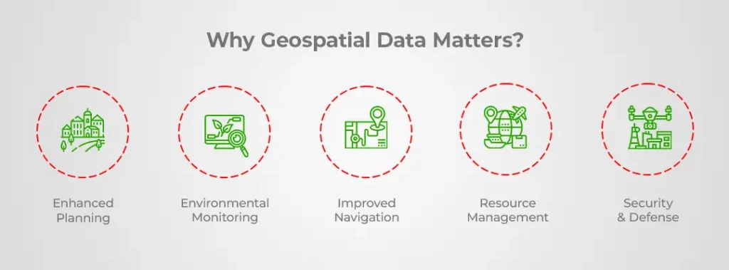
The demand for geospatial data continues to rise as industries recognize its value in decision-making and operational efficiency. Key benefits of geospatial data include:
- Enhanced Planning: Helps urban planners and developers design smarter cities.
- Environmental Monitoring: Assists in tracking climate change, deforestation, and natural disasters.
- Improved Navigation: Supports real-time traffic updates and route optimization.
- Resource Management: Aids in precision agriculture, logistics, and infrastructure development.
- Security & Defense: Provides critical intelligence for national security and disaster response.
Conclusion
The geospatial data industry is rapidly evolving, driven by technological advancements in AI, satellite imaging, and cloud-based analytics. Companies like Macgence are at the forefront, delivering training data for innovative solutions that empower industries with accurate and real-time geospatial insights. As the industry continues to grow, businesses and governments will increasingly rely on geospatial data collection providers to enhance decision-making and drive smarter solutions.
Looking to leverage geospatial data for your business? Stay ahead by exploring the latest advancements and partnering with leading providers in the industry!
FAQs
Ans: – Geospatial data collection refers to the process of gathering information related to specific locations on Earth using techniques such as GPS, satellite imagery, remote sensing, and LiDAR.
Ans: – Geospatial data is essential for urban planning, environmental monitoring, navigation, security, and various industries as it helps in making data-driven decisions and improving operational efficiency.
Ans: – Companies collect geospatial data using various methods, including satellite imaging, aerial drones, ground-based sensors, and Geographic Information Systems (GIS) tools.
Ans: – Industries such as agriculture, transportation, logistics, real estate, defense, environmental management, and urban planning benefit from geospatial data.
Ans: – Macgence stands out due to its AI-driven solutions, high-quality mapping services, automated data annotation, and advanced analytics, helping businesses optimize operations with geospatial intelligence.
Ans: – Future trends include AI-powered automation, real-time data processing, improved satellite imagery resolution, the expansion of IoT in geospatial data, and increased use of cloud-based geospatial analytics.
 Previous Blog


You Might Like

June 18, 2026
Mastering Teleoperation Data Annotation for Robotics
The demand for intelligent robotics and autonomous systems is accelerating at an unprecedented rate. As machines take on increasingly complex tasks, developers face a significant hurdle: teaching robots how to navigate the unpredictable nature of real-world environments. Teleoperation bridges the gap between human intelligence and machine learning by allowing humans to guide robots through specific […]

June 17, 2026
Choosing the Right Image Annotation Companies for AI Growth
Behind every successful computer vision model is an enormous volume of high-quality labeled data. AI systems depend entirely on this foundational layer to understand, interpret, and react to the visual world. Image annotation serves as the bedrock of computer vision. Without it, the sophisticated algorithms powering modern technology simply cannot function. Countless industries rely heavily […]

June 15, 2026
Why Teleoperation Data Collection Is Critical for AI-Powered Robotics?
Teleoperation lets a human operator remotely control a robot, drone, or vehicle from a distance, often using cameras, sensors, and a control interface. As robotics and autonomous systems move from labs into warehouses, farms, and city streets, they need vast amounts of real-world operational data to learn from. That’s where teleoperation data collection comes in. […]